Help centerSet up your workspace
Sites
Choose a site type, create sites on a reef, and map their location.
Site types
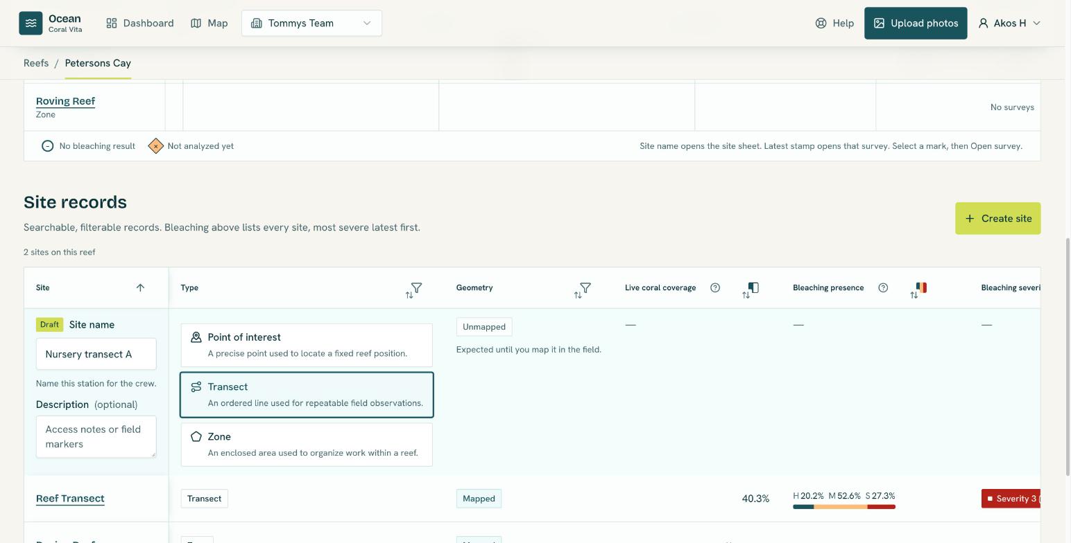
A site is a place on a reef where you survey. Its type decides the shape you draw on the map:
| Type | Shape | Use it for |
|---|---|---|
| Point of interest | One point | A precise point used to locate a fixed reef position. |
| Transect | A line of 2 or more points | An ordered line used for repeatable field observations. |
| Zone | An area of 3 or more points | An enclosed area used to organize work within a reef. |
The dashboard's site tables label points of interest as Anchor.
Create a site
- Open the reef (from the dashboard or the trail at the top of a page) and select Create site.
- Enter a Site name, an optional description (access notes or field markers), and choose a Site type.
- Select Create site. Use Open site to add surveys, or Map location to place it on the map.
You can also create a site while uploading photos: if your organization has no sites yet, the upload page asks you to click the map and name the location. See Upload survey photos.
Map the site location
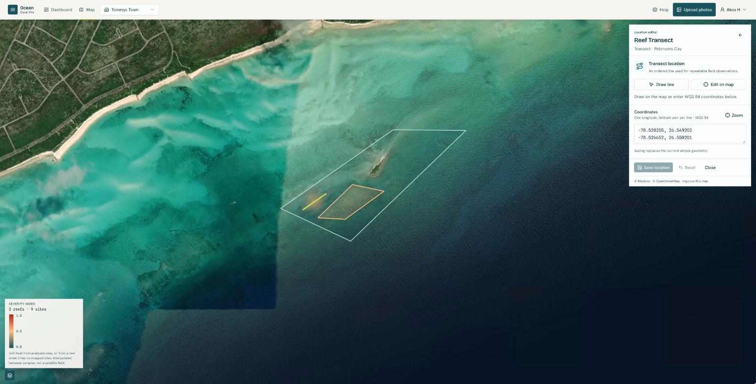
- On the site page, select Map this site, or open the site on the Map and choose Map location.
- Use Place point, Draw line or Draw polygon depending on the site type, or type the coordinates (one longitude, latitude pair per line).
- Select Save location. Map later leaves it unmapped for now.
A mapped site gives the most accurate NOAA heat stress lookup and appears in the map's bleaching heatmap.
Edit or delete a site
On the site page, Edit site changes the name and description. To move it, use Edit location on the map. Delete site removes the site with its surveys and photos; administrators can delete any site, members the sites they created.